| Home |
| U.S 89: Skip It (If You're Not Scott), Highway 12: Dont Miss It! - Part 2 | |
|
08/15/07 - Panguitch, UT Veering off the agenda, we decide to take an unplanned detour to Zion and Bryce Canyon National Parks, by way of Salt Lake City |
(Shutterfly photo album - Utah Parks & Aztec Ruins) |
|
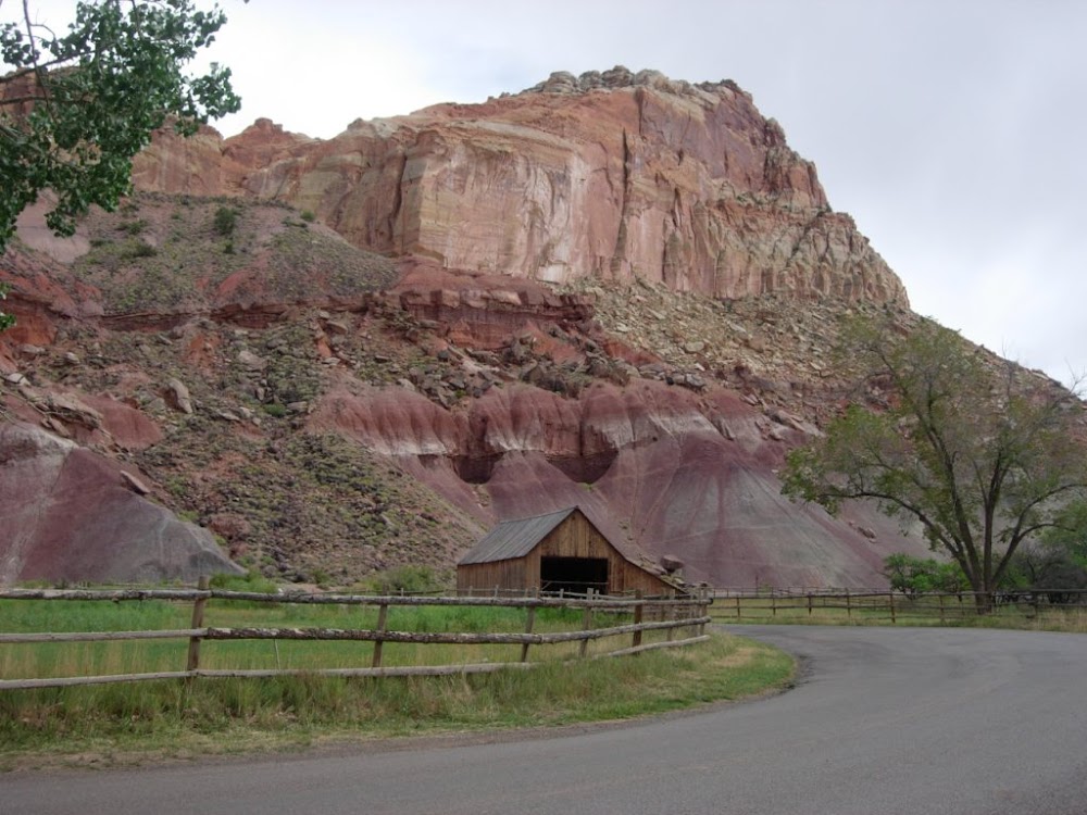
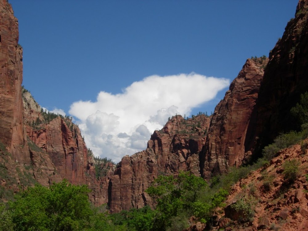
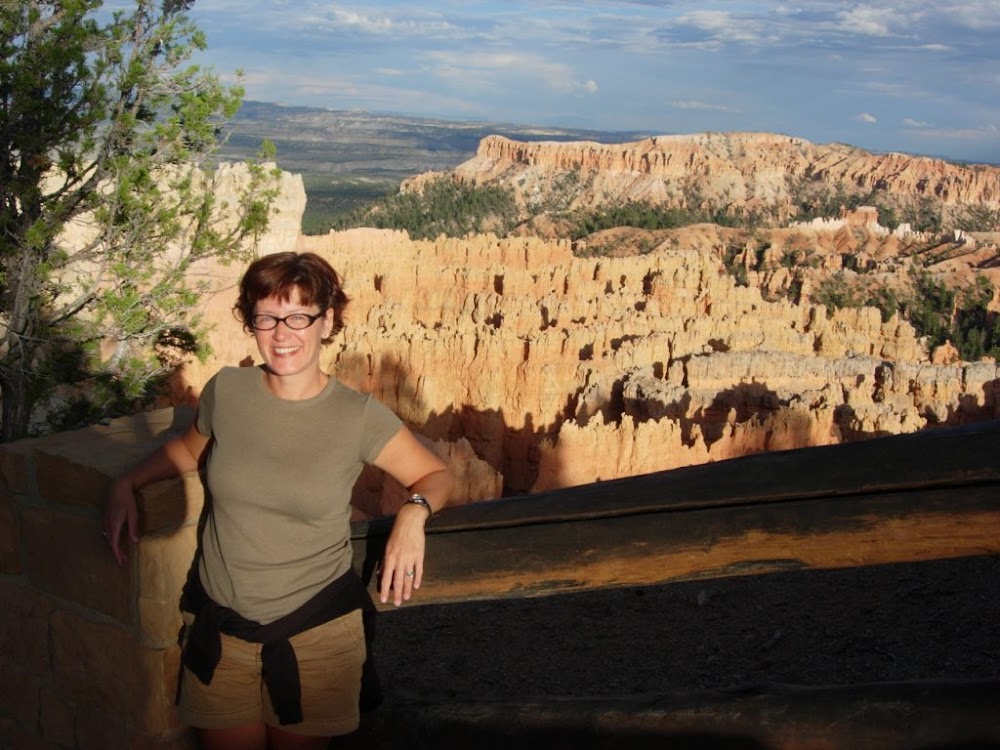
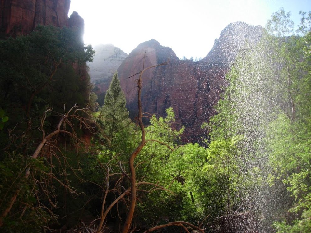
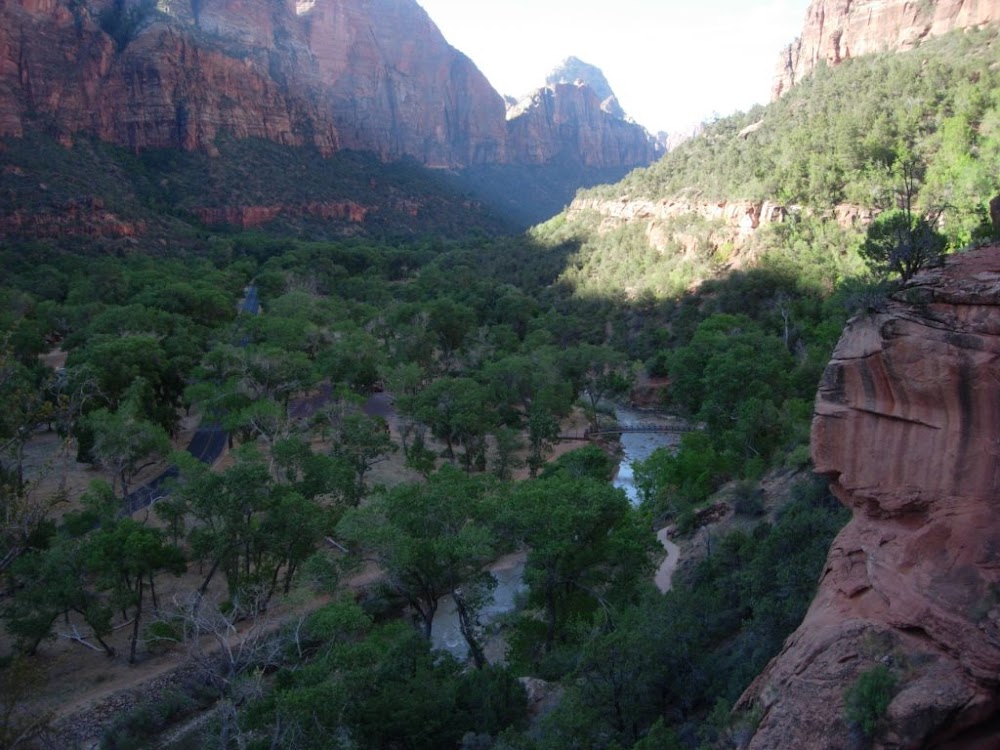
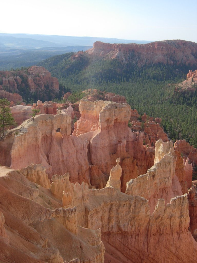
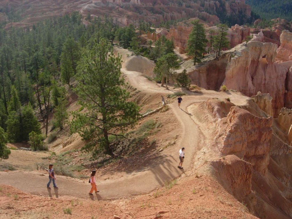
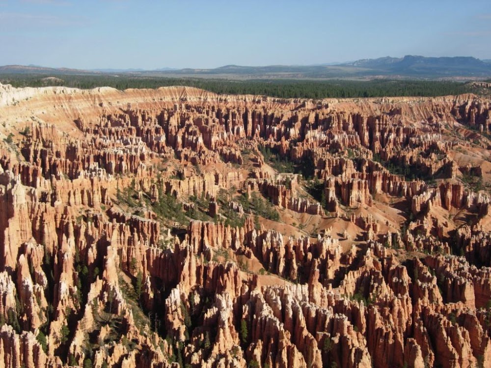
After checking out of the Quality Inn in Springdale, we drove back into Zion this morning to see some more scenery and attempt a short hike or two. We decided to hike the Emerald Pools waterfall trails and for a real adventure, the Narrows. The Narrows, a relatively narrow (though wide in comparison with New Mexico's Tent Rocks area) and deep canyon, has a paved 1-mile trail running along the river. At the end of the trail, the river widens to fill the canyon from wall to wall. Here, you either turn around or head into the shallow (1 to 2 feet deep) river and keep slogging ahead. After missing our opportunity at the Oneonta Gorge in the Columbia River Valley, we decided to jump in head first (figuratively) and get our feet wet (literally). It was a cool sensation to be walking in the river with the canyon walls rising above you on both sides. Caroline was most fascinated, however, at the number of people willing to jump into the river in their shoes, socks and pants. Her wet feet and sand-filled shoes made the final part of the Narrows walk, while intriguing, not quite worth the discomfort and required later shoe cleaning. Scott was fine. We decided to continue our strategy of arriving at the parks in the late afternoon/early evening and, after our hikes in Zion, we went in search of a motel for the night in Panguitch, located not too far outside Bryce Canyon. We settled on the recently remodeled (somewhat) Purple Sage Motel, where Caroline rinsed out the mounds of fine sand from our socks, acquired during our earlier adventures hiking in the river at the Narrows. After a quick BBQ meal in town (with more terrible service!), we headed to Bryce for an evening preview of the Amphitheater. It's 7pm, so where better to start, we decided, than Sunset Point! And a fine place to start it was. Amazing rock formations (hoodoos), spectacular colors in the evening light, another park not to be missed, if one is in southern Utah. We drove the 17-mile length of the north-south road leading through the park, stopping off at several of the most scenic of viewpoints. One interesting thing (but not the most interesting) was the fact that in Bryce Canyon National Park we were some of the only English-speaking people there. At LEAST half of the visitors were French, with a strong contingent of Italians as well, and one British group. We kept having to remind ourselves that we were still in the U.S. It was like that in Zion too, but didn't seem quite as pronounced. Tomorrow is the last of our super-busy-travel days, as we head east through Utah, visiting more parks and monuments, and slowly approaching Albuquerque. Tempting as it is to spend more time on the road, the days and days of dawn to dusk activity are helping us feel like we'll be ready to head home when the time comes.
|
|
| Bryce Canyon N.P., Red Canyon, Grand Staircase-Escalante N.M., Capitol Reef N.P. & Natural Bridges N.M. | |
|
08/16/07 - Cortez, CO Making damn sure this annual National Parks pass pays for itself - or - 'No More Red Rock!' |
(Shutterfly photo album - Utah Parks & Aztec Ruins) |
|
Highway 12 is one of the most scenic roads in the country,
winding through Red Canyon, by Bryce Canyon, through Grand
Staircase-Escaclante and up to Capitol Reef National Park.
There are not many places on the road where you're not driving
by absolutely spectacular landscape and it just seems to go on
and on, one gorgeous mile after another. If you ever have
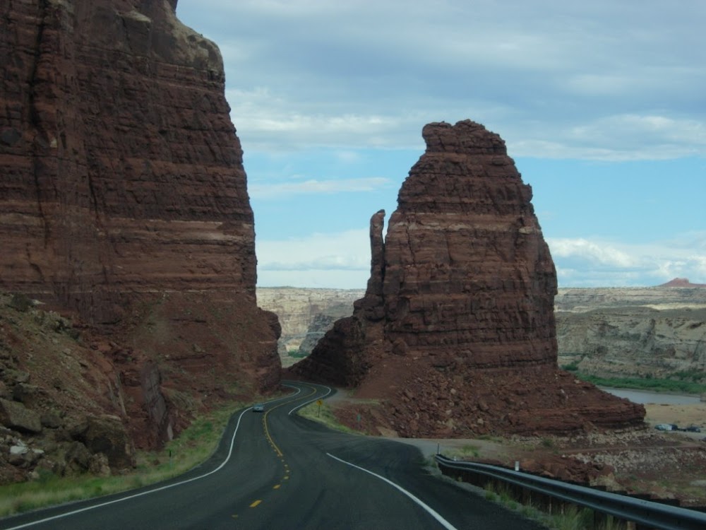
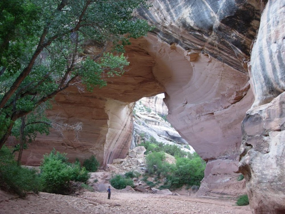
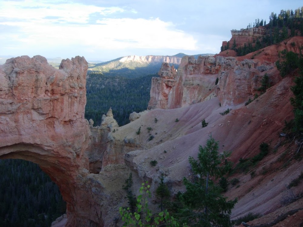
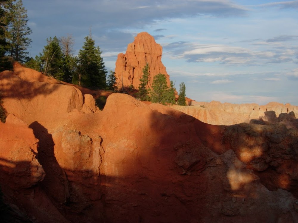
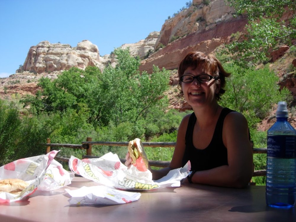
the chance to drive this road, do it. Seriously. When you take Highway 12 east toward Bryce, you pass right through the Red Canyon area in Dixie National Forest. Dark red cliffs and rock formations, a new bike path extending the length of the park, drive-through tunnels carved in the red rock, a site worth seeing in its own right. We stopped to take a quick look before trying to catch the morning light (and morning temps) in Bryce, where we walked a short while into the amphitheater on Fairy Loop Trail. We actually encountered TWO English-speaking American couples... amazing! Next down the road was Grand Staircase-Escalante National Monument. First thing we have to say about that is, we can't wait to go back and explore. There was nary a soul in sight, but spectacular landscape all around. Not planning to spend much time here, we quickly picnicked (quicknicked?) down by Calf Creek before taking a diversion down Burr Trail Road. The spectacular red rock scenery just keeps getting better; Burr Trail really surprised us, as we found ourselves driving through a snaking road at the bottom of an amazing canyon. If only we had more time (and 50 gallons of water) we'd love to have explored this part of the park further. The amazing Highway 12 drive ended for us at Capitol Reef National Park, where we headed west onto Highway 24. Although also chock-full of beautiful red rock landscape, this park was different from the rest. The park was settled by early Mormon settlers in the last half of the 19th century, where they farmed, started orchards, and built a few structures that still stand, including a schoolhouse and farmhouse (where we bought a delicious freshly baked peach pie to tide us over). There are also some impressively preserved petroglyphs on some of the cliff walls, making this a park with a little bit more to see and learn about than some others - good to hold kids' interest after a couple of days of red-rock-peeping. It was getting late when we left Capitol Reef, so we decided we'd probably pass up Natural Bridges National Monument. That is, until we drove by the sign and couldn't resist 'just taking the scenic loop drive'. That is, until we saw the trail down into the canyon to Kachina Bridge, where we just had to take the one-mile hike to get a closer look. This would be a great park to spend half of a day or more and hike to each of the bridges. But since it was almost dark by the time we got back to the entrance station, this was obviously not that day. Good bye Utah, we made it as far as Cortez, Colorado tonight - the hopping off point for Mesa Verde National Park (where we will NOT be heading tomorrow - straight to Albuquerque!). Being back in Colorado really makes it feel like our loop is nearly complete.
|
|
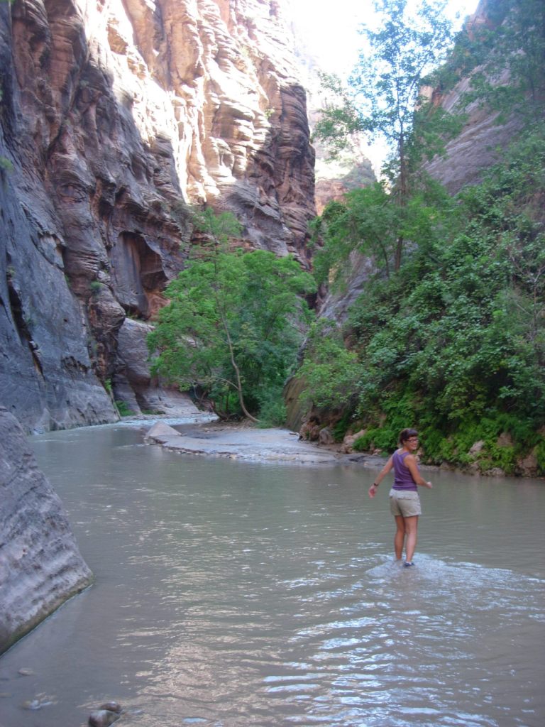
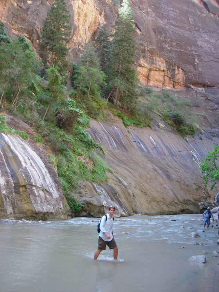
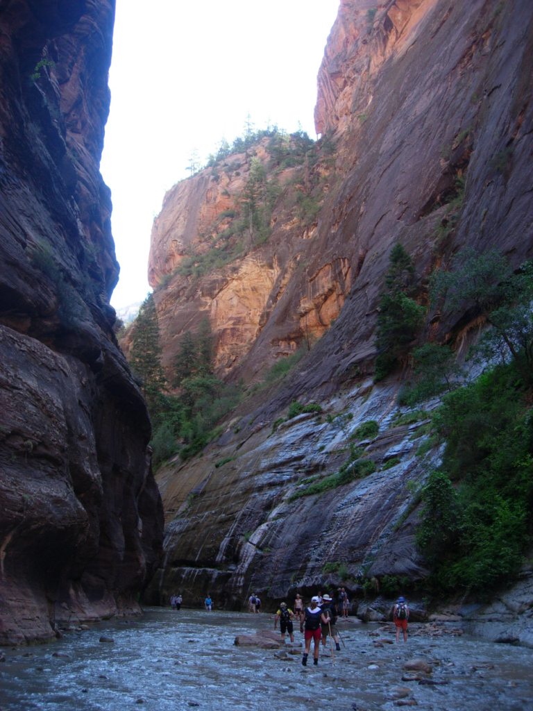
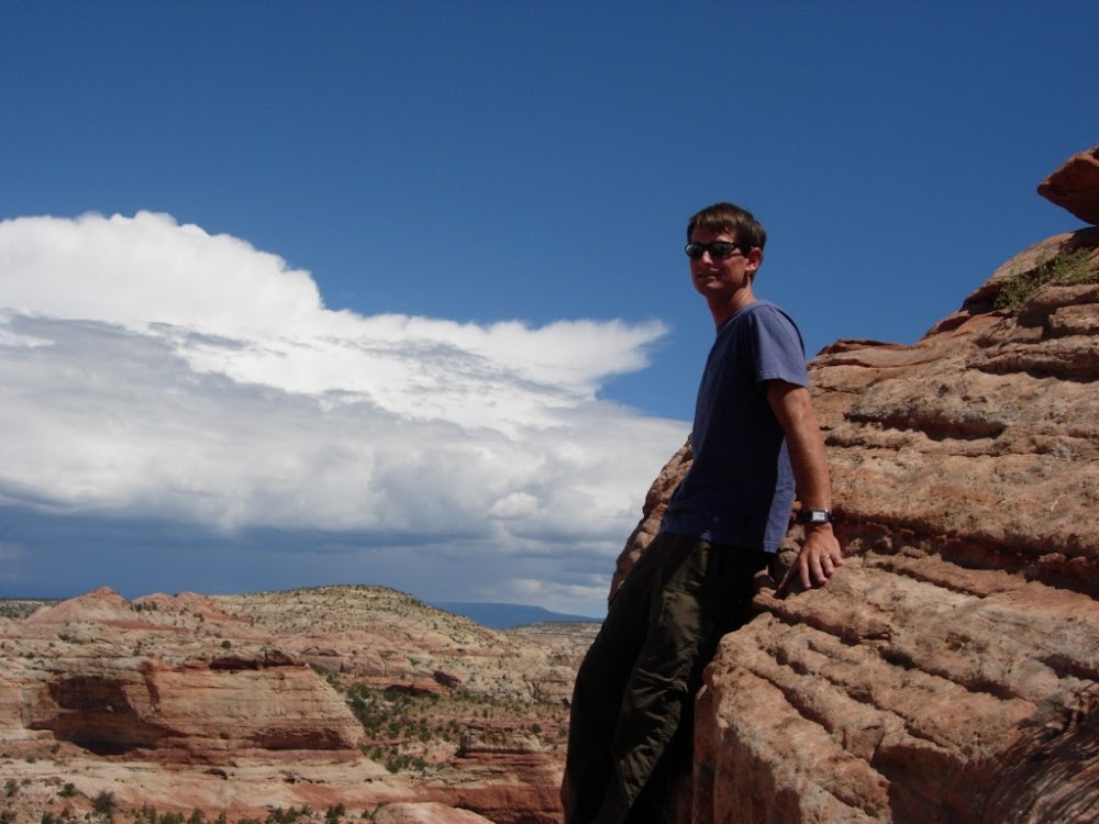
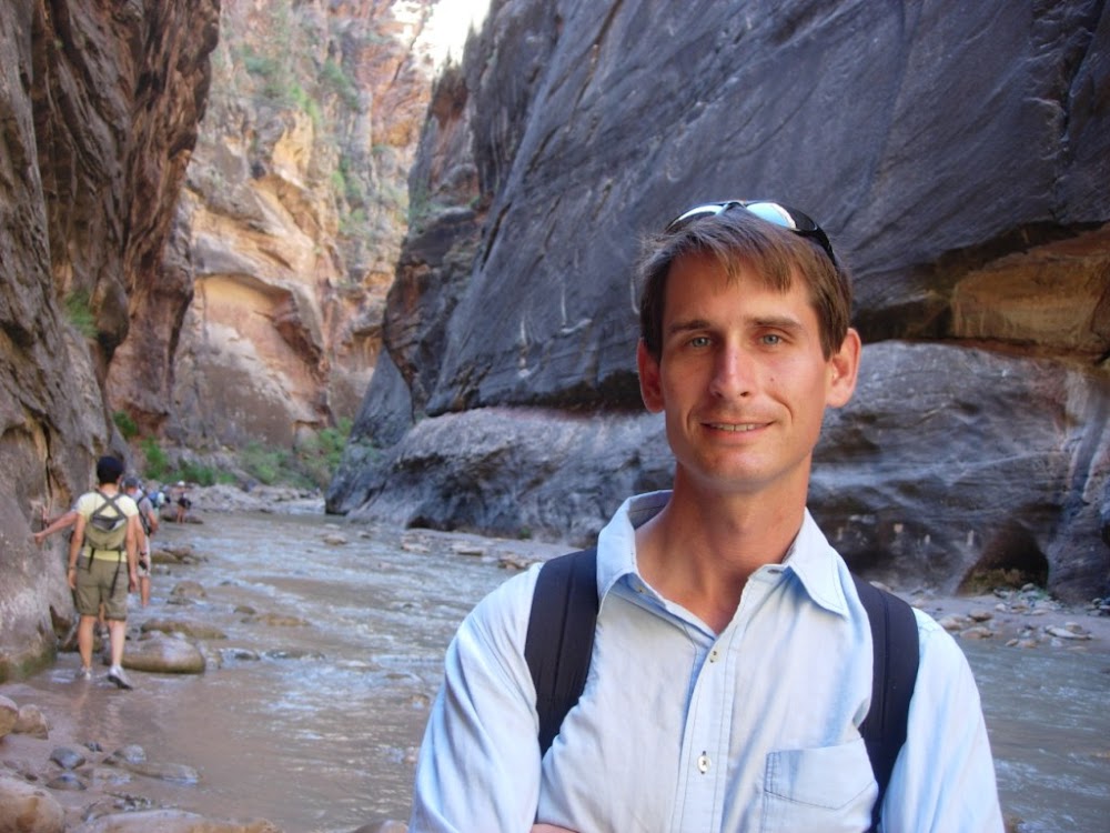 The Narrows - Scott's fine
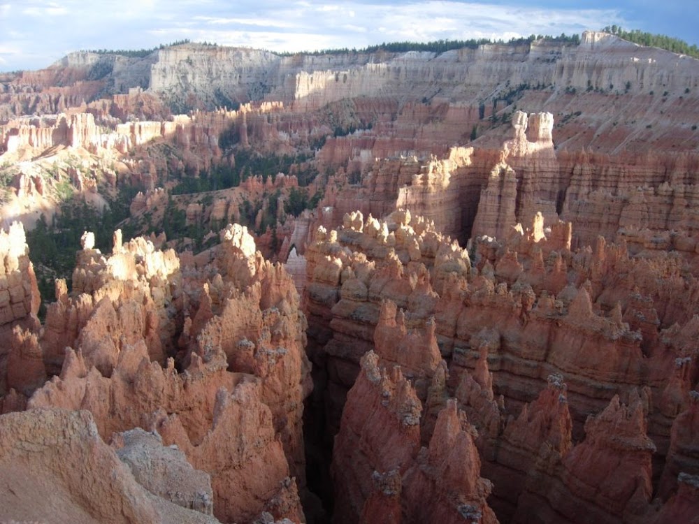
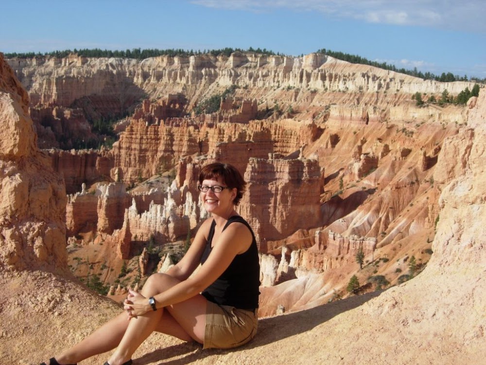
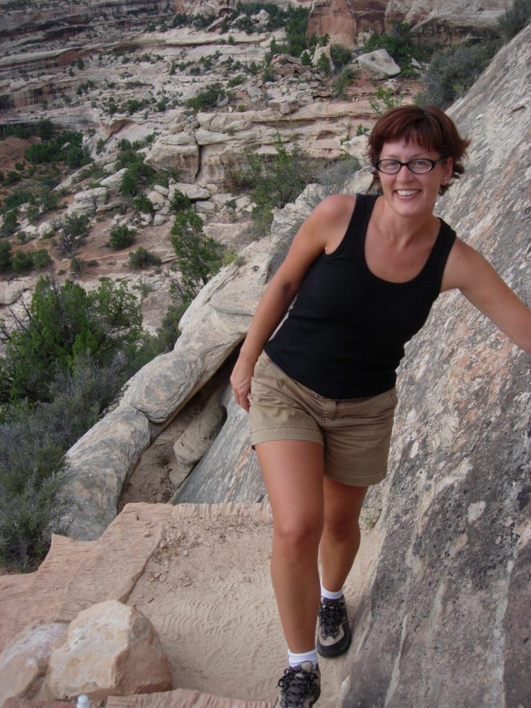

 Caroline lunches at Calf Creek in Grand Staircase-Escalante